![]()
Marion Co TOC
Homepage
Awards
Cemeteries
Census Records
Courthouse Info
Family Genealogies
Heritage Society
Society's Newsletters
History + more
Marion History-book
Maps
Marion Co Timeline
Marriages
Mt Meadow Massacre
Newspapers
Obits
Photo Gallery
Post Office History
Townships
Transcribed Records
Helpful Links
Contact -
Jeana
Marion Co, AR
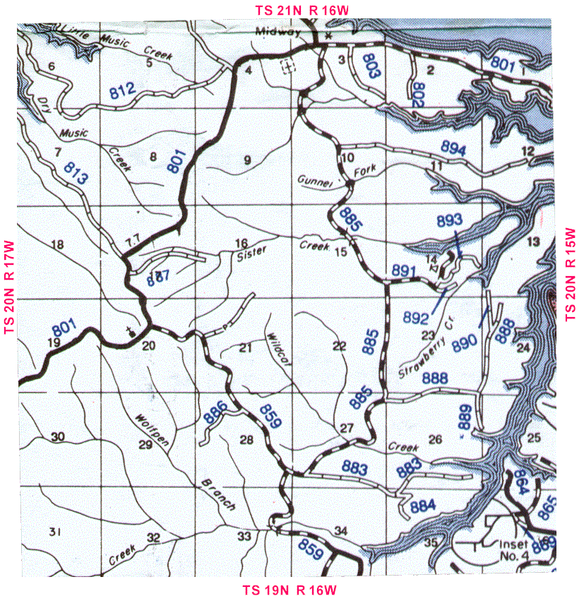
Federal Township Map
Township 20 N, Range 16 W
If you don't understand Federal (Congressional) Townships
(Sections/ Townships / Ranges) take a minute and read an explanation
Marion County Township map that includes Federal Townships
![]()
The numbers inside the squares are sections numbers
Descriptions in Red at the top, bottom & sides are
bordering townships and/or counties
Blue numbers inside the map are AR state road numbers
![]()

![]()
Return to Federal & County Township Maps
Return to Township Index
Return to Map Index
Return to Marion Co Home Page

