![]()
Landowners Indexes
E
F
G
H
I
J
K
L
M
N
O
P
Q
R
S
T
U
V
W
X
Y
Z

Marion Co TOC
Homepage
Awards
Cemeteries
Census Records
Courthouse Info
Family Genealogies
Heritage Society
Society's Newsletters
History + more
Marion History-book
Maps
Marion Co Timeline
Marriages
Mt Meadow Massacre
Newspapers
Obits
Photo Gallery
Post Office History
Townships
Transcribed Records
Helpful Links
Contact -
Jeana
Graphics by Rhio

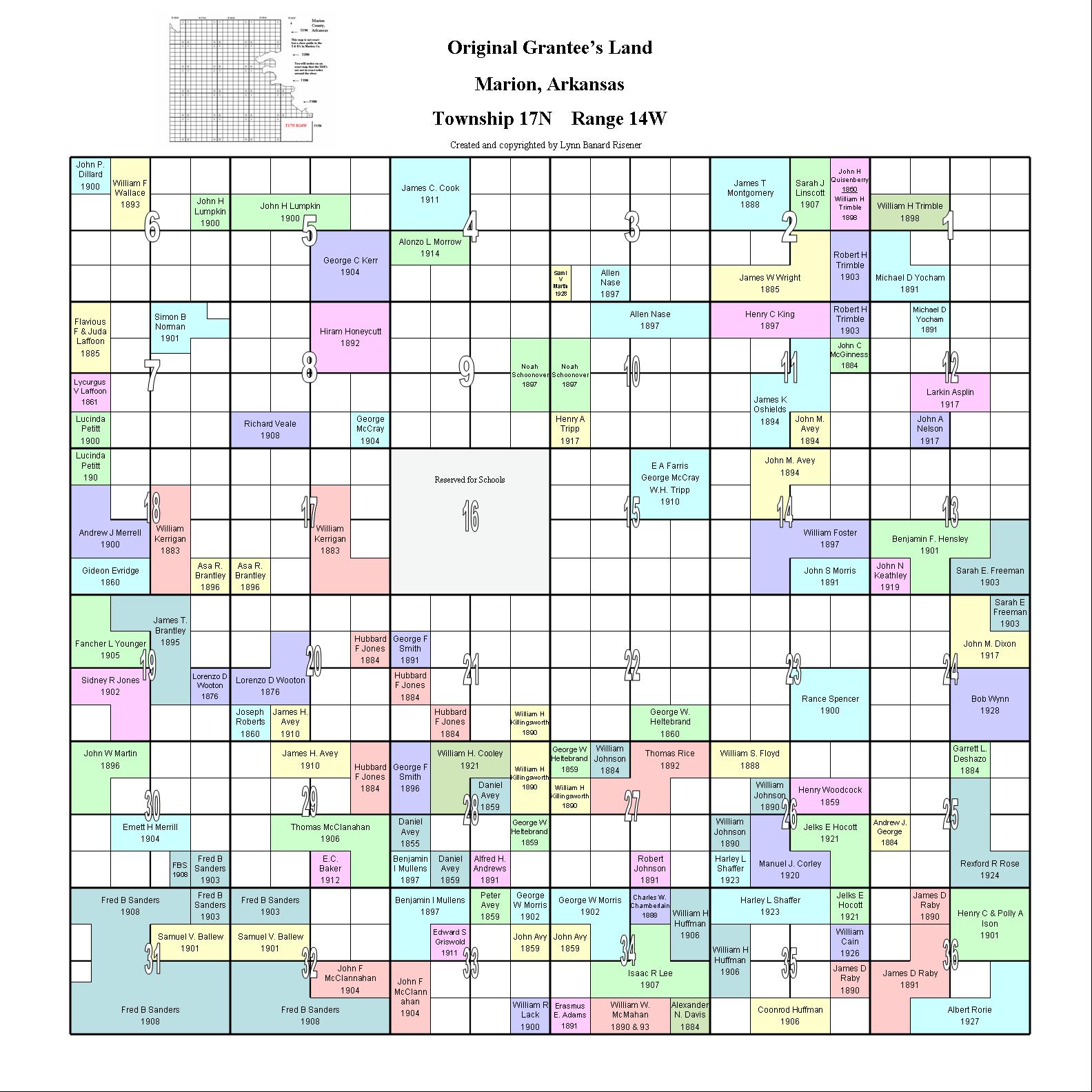
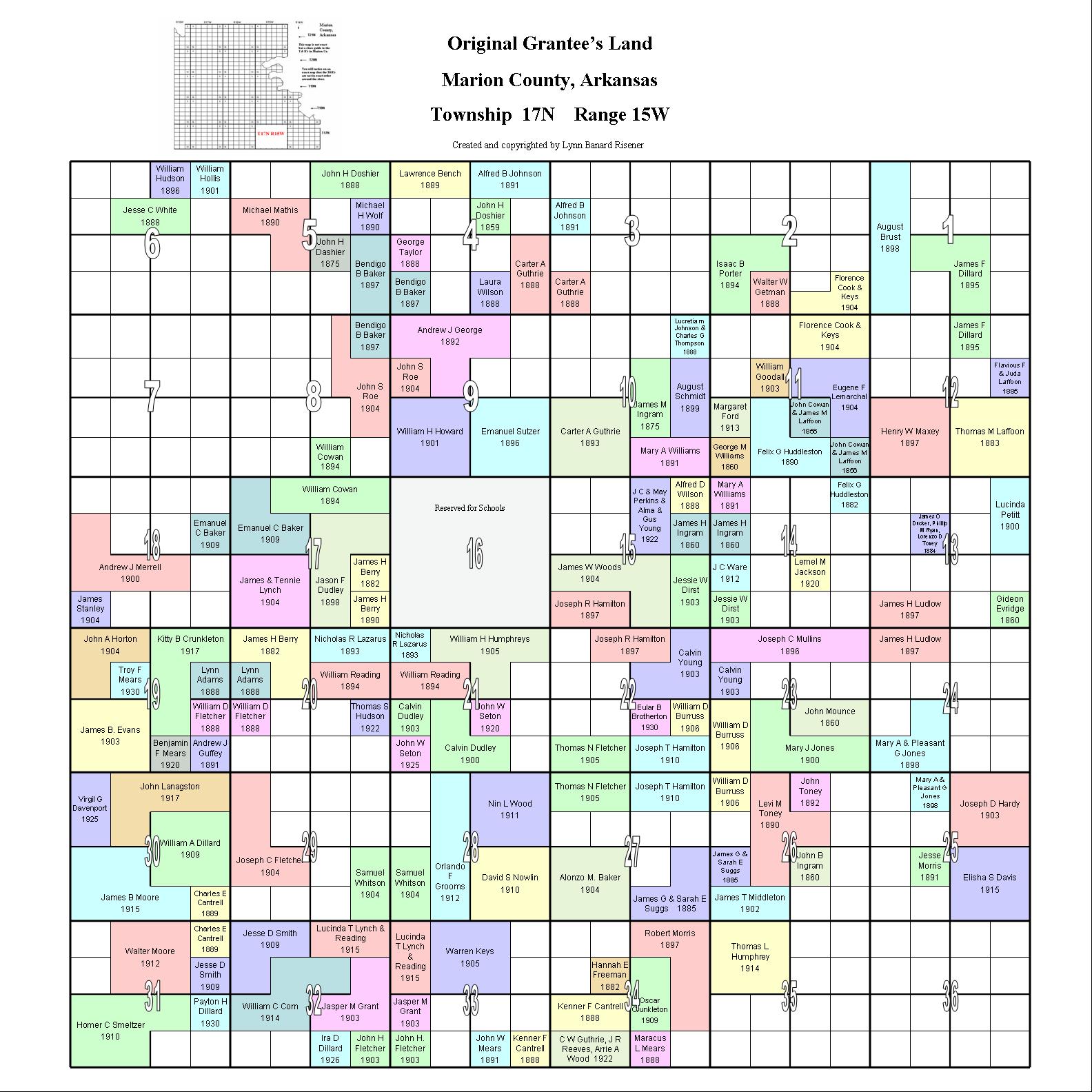
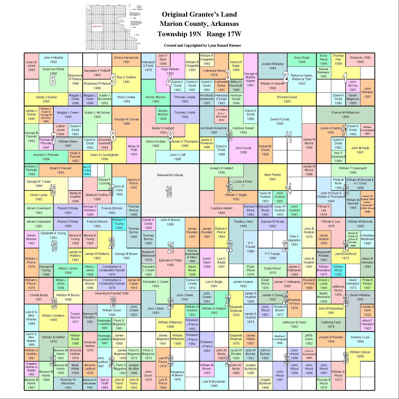
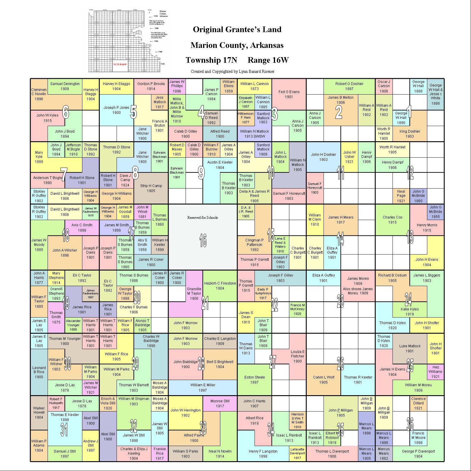
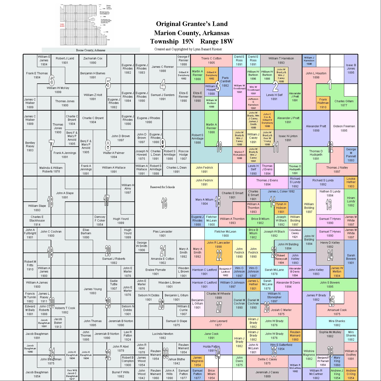
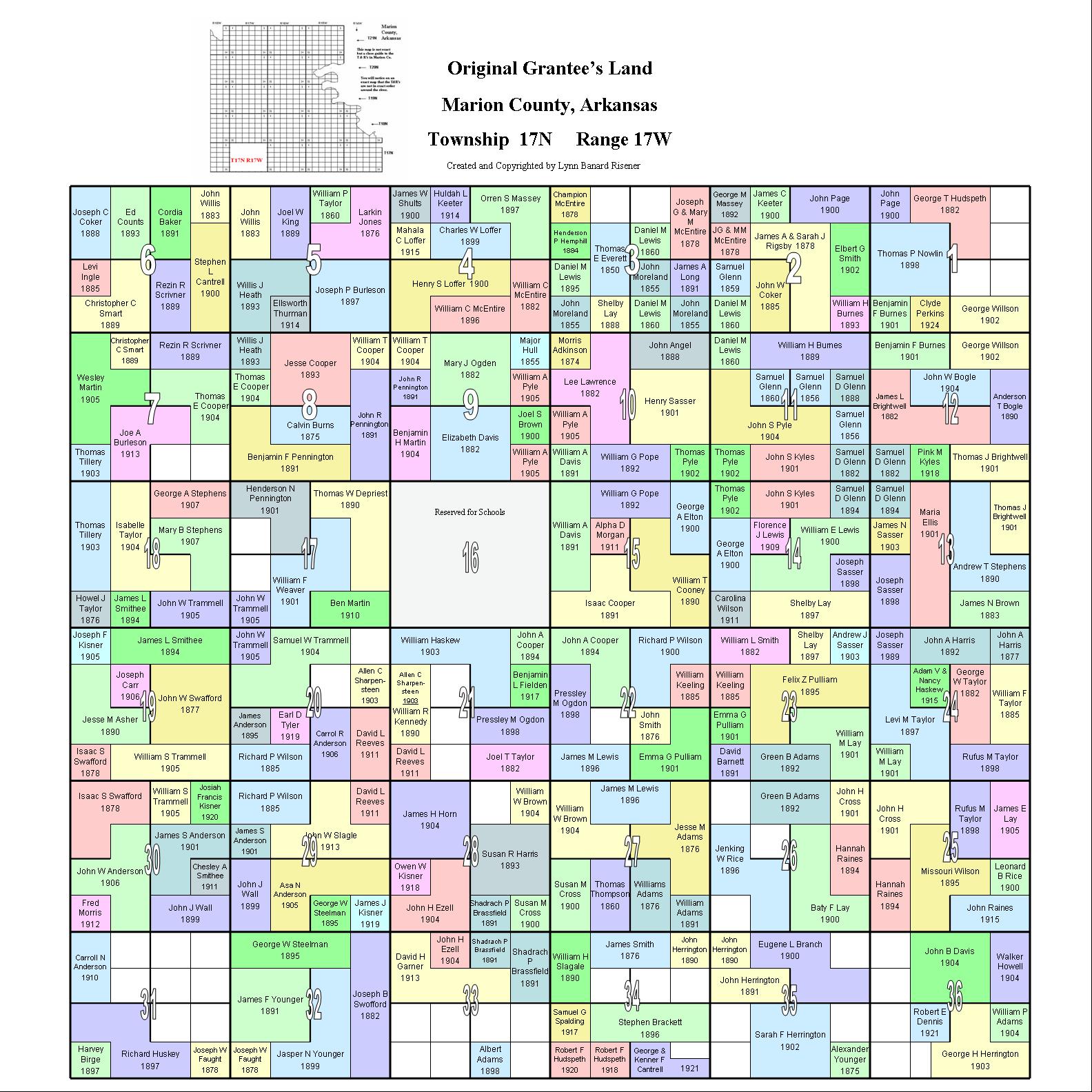
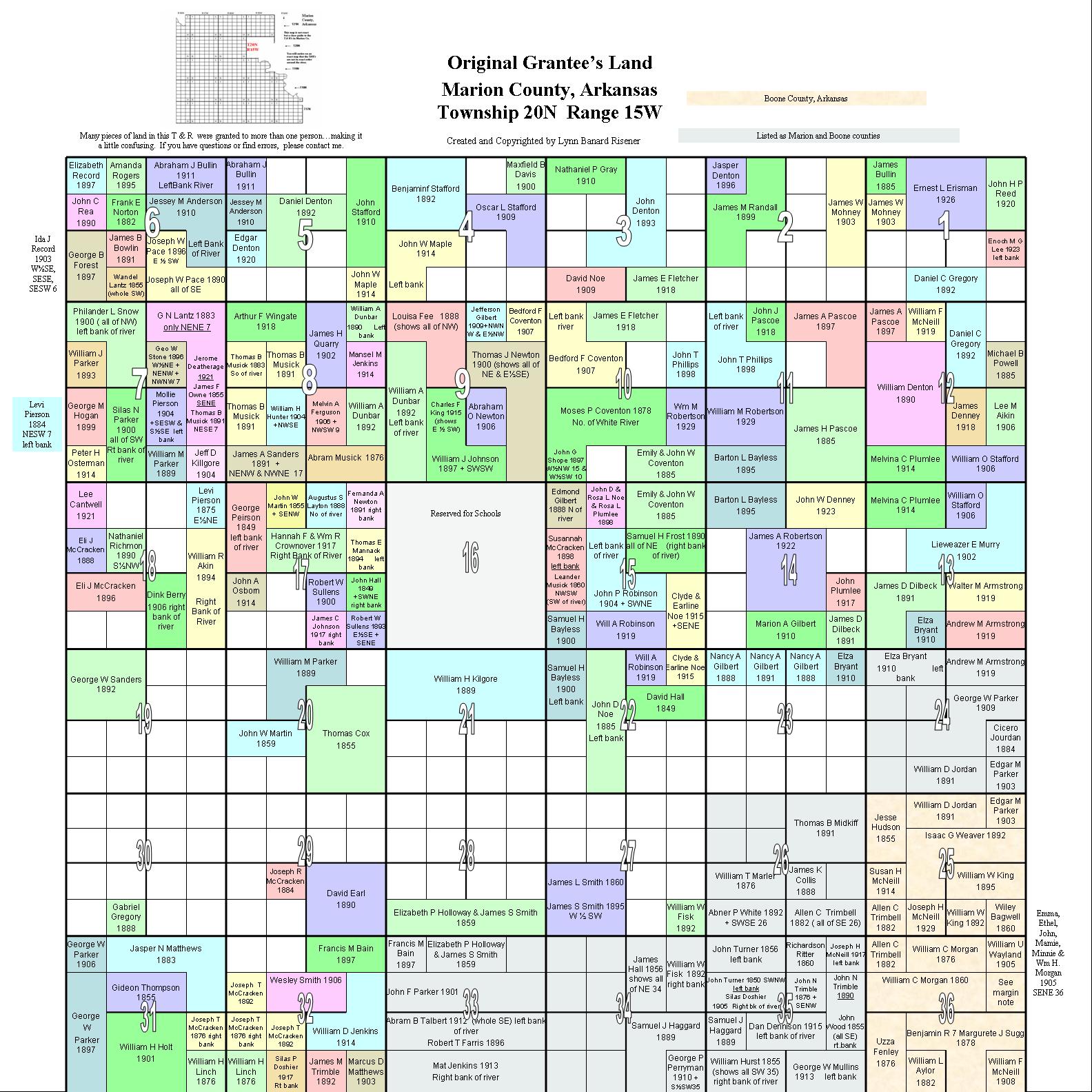
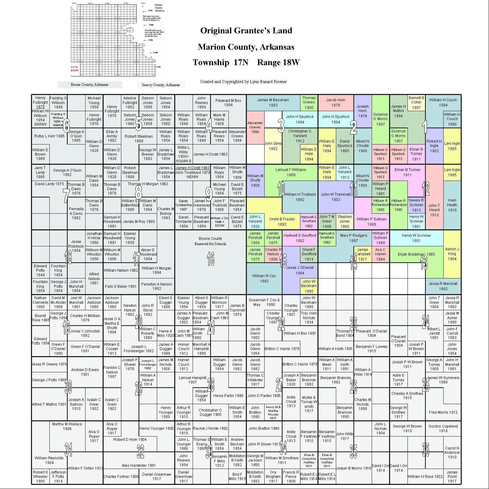
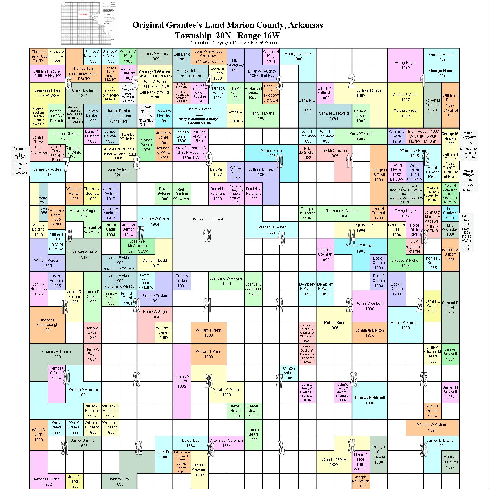
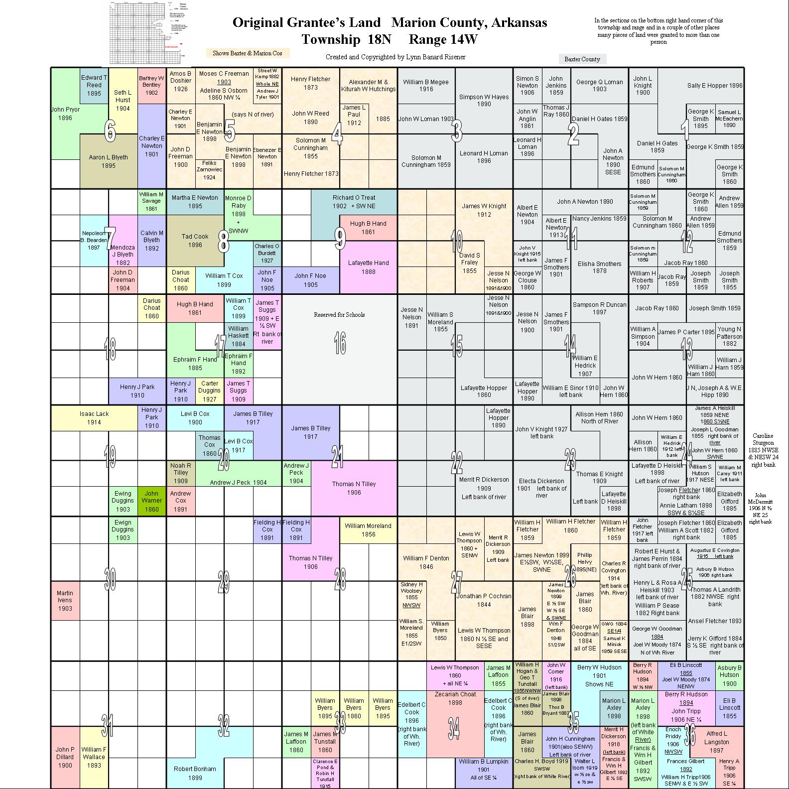
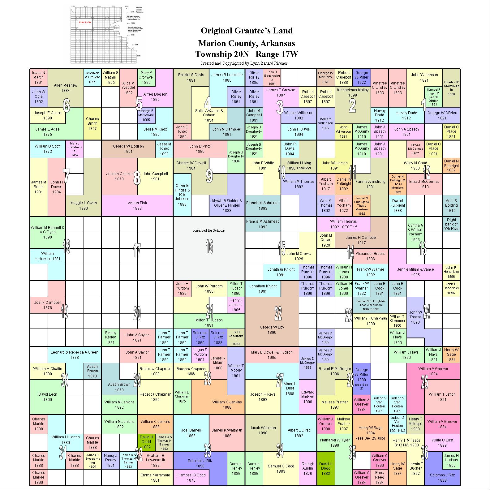
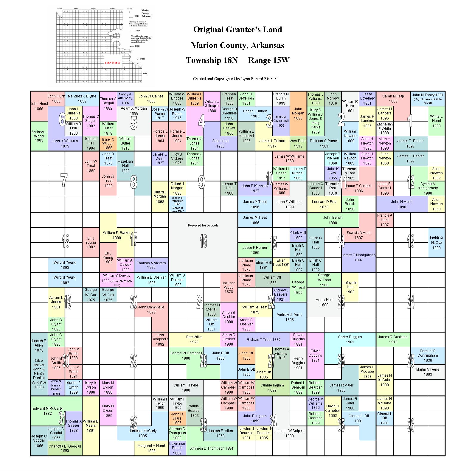
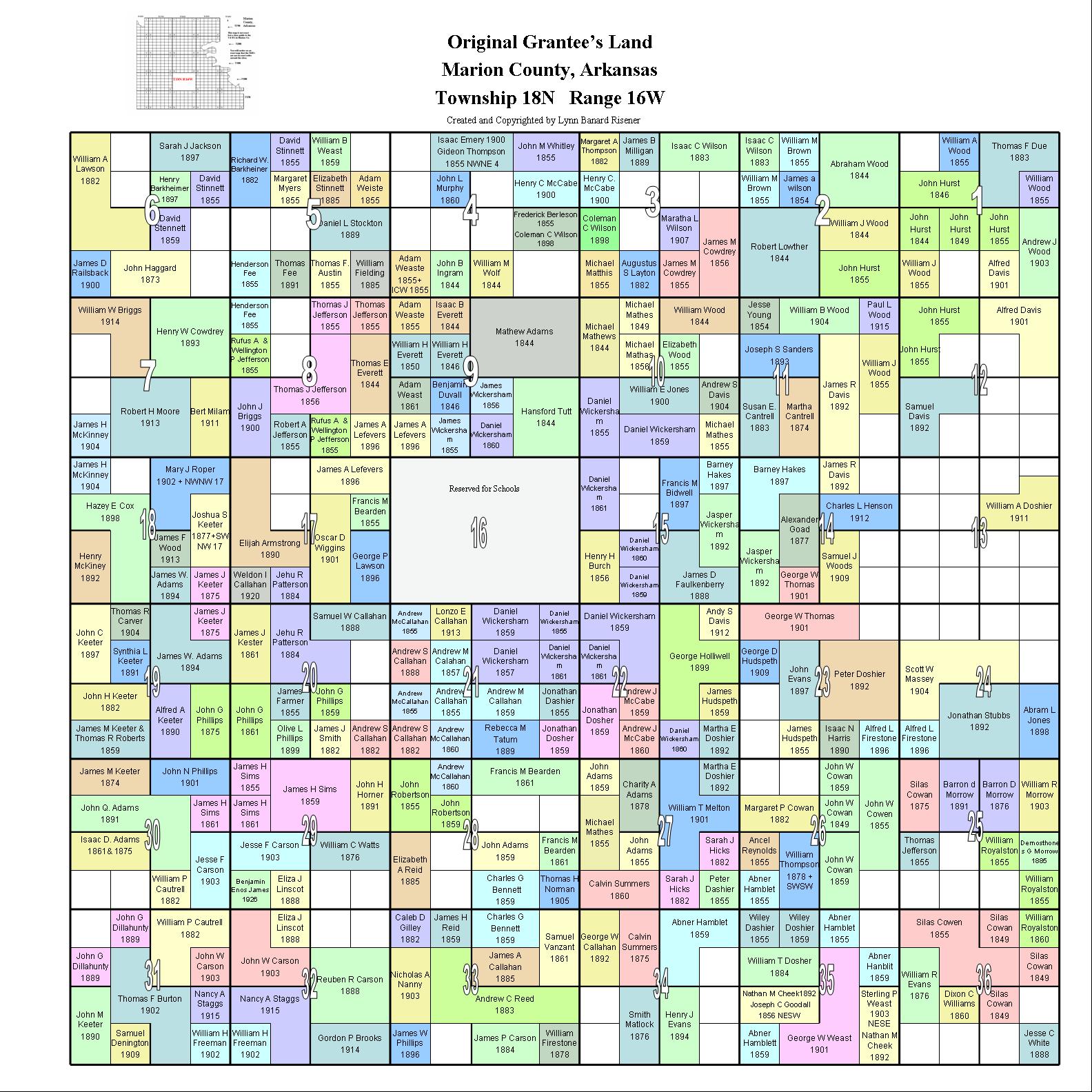
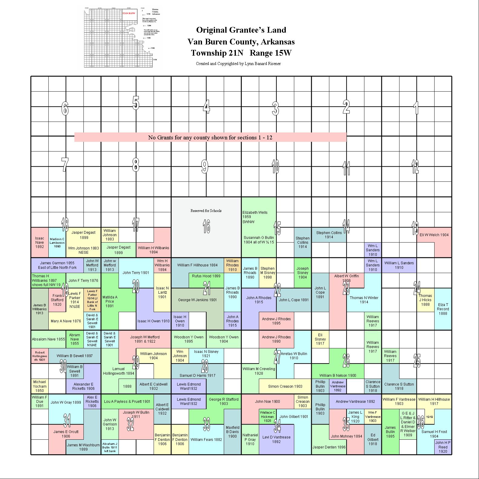
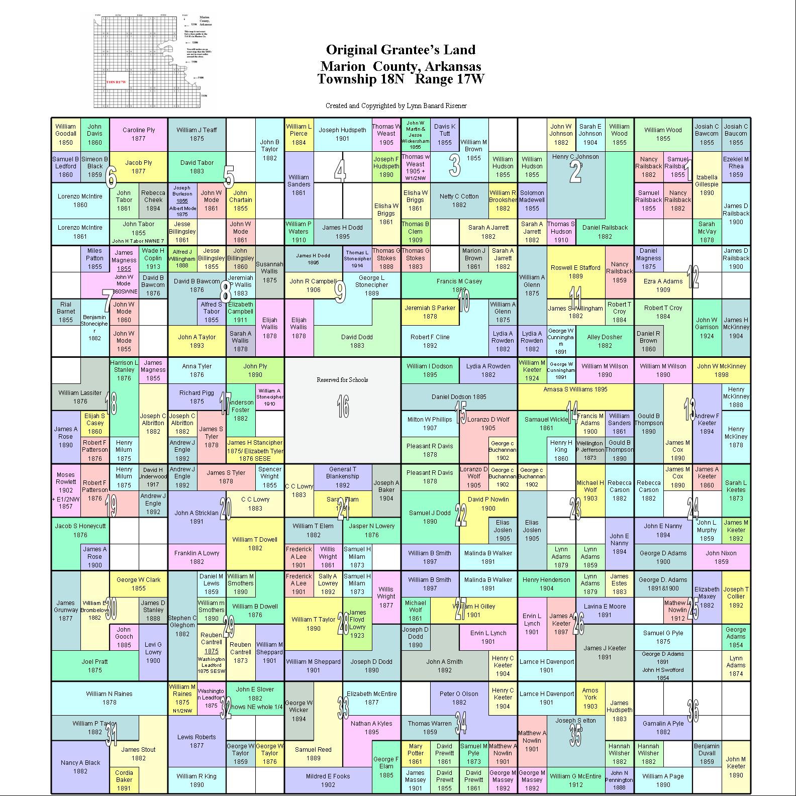
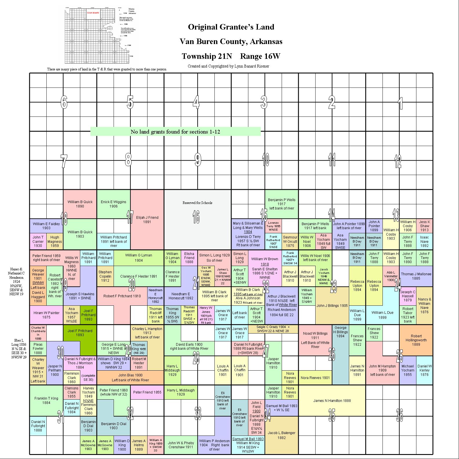
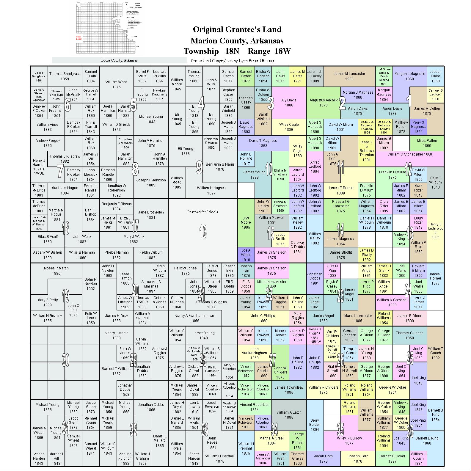
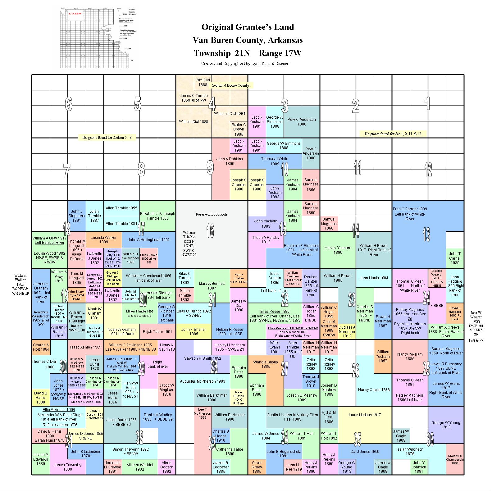
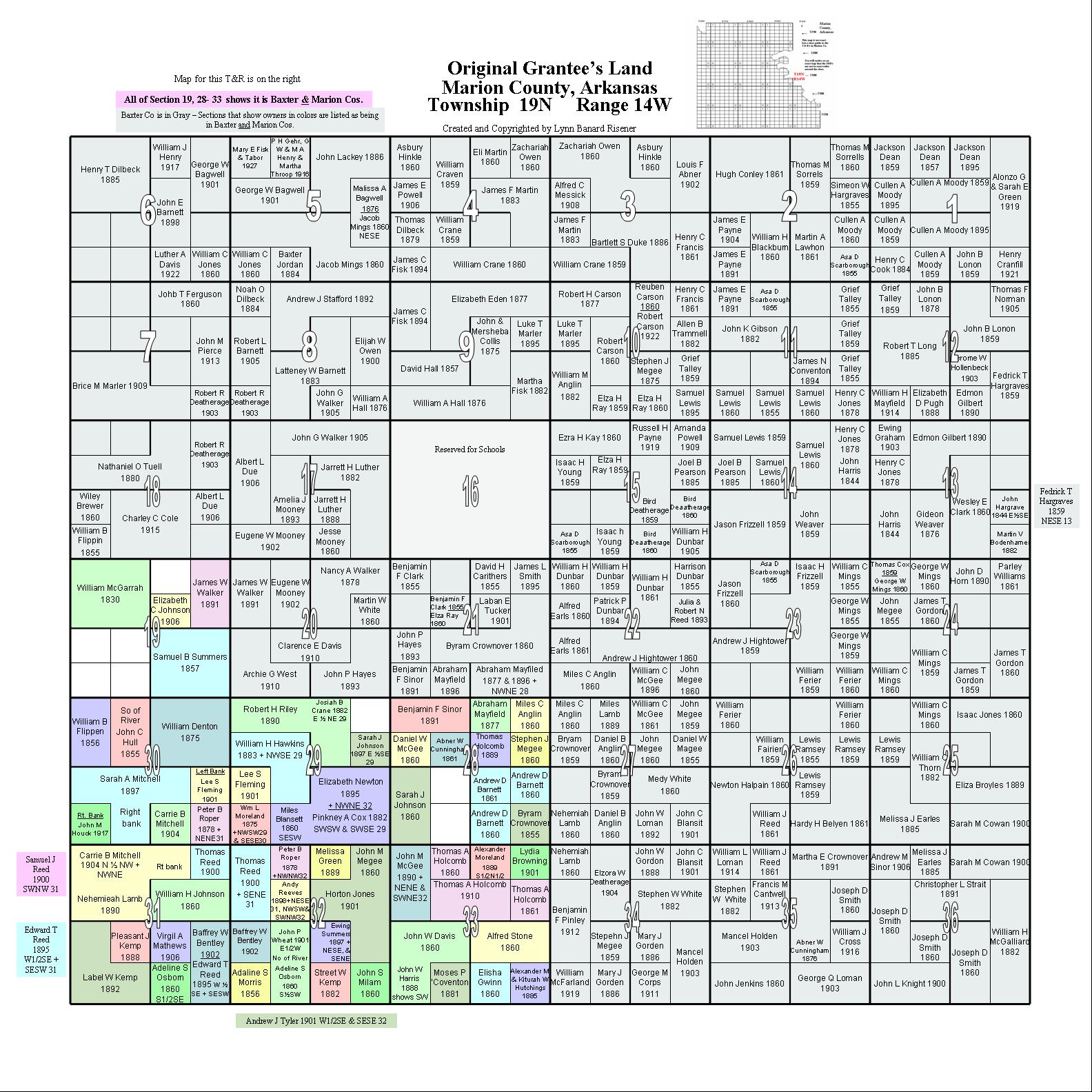
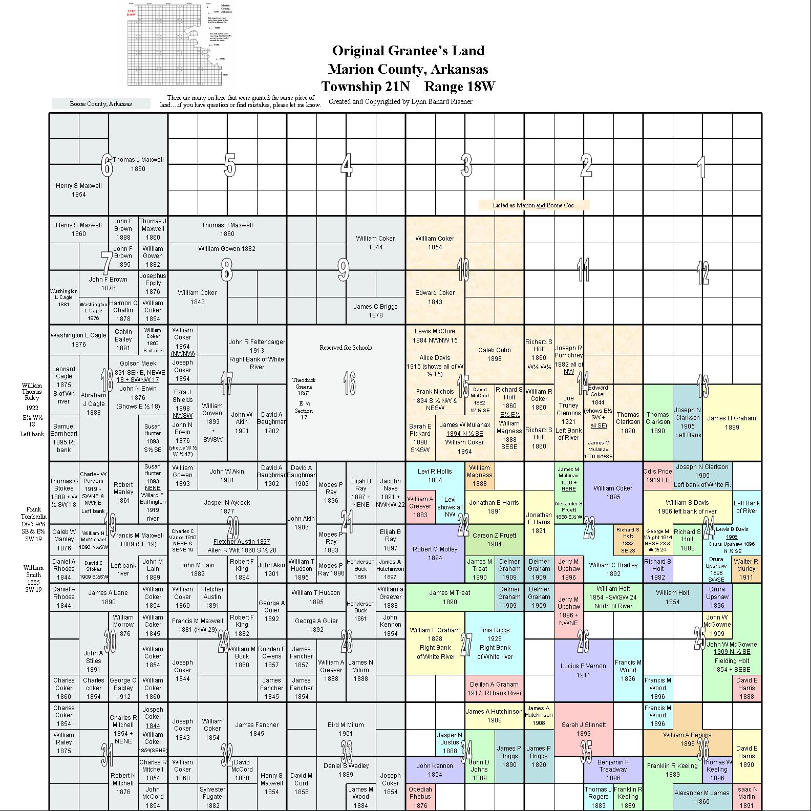
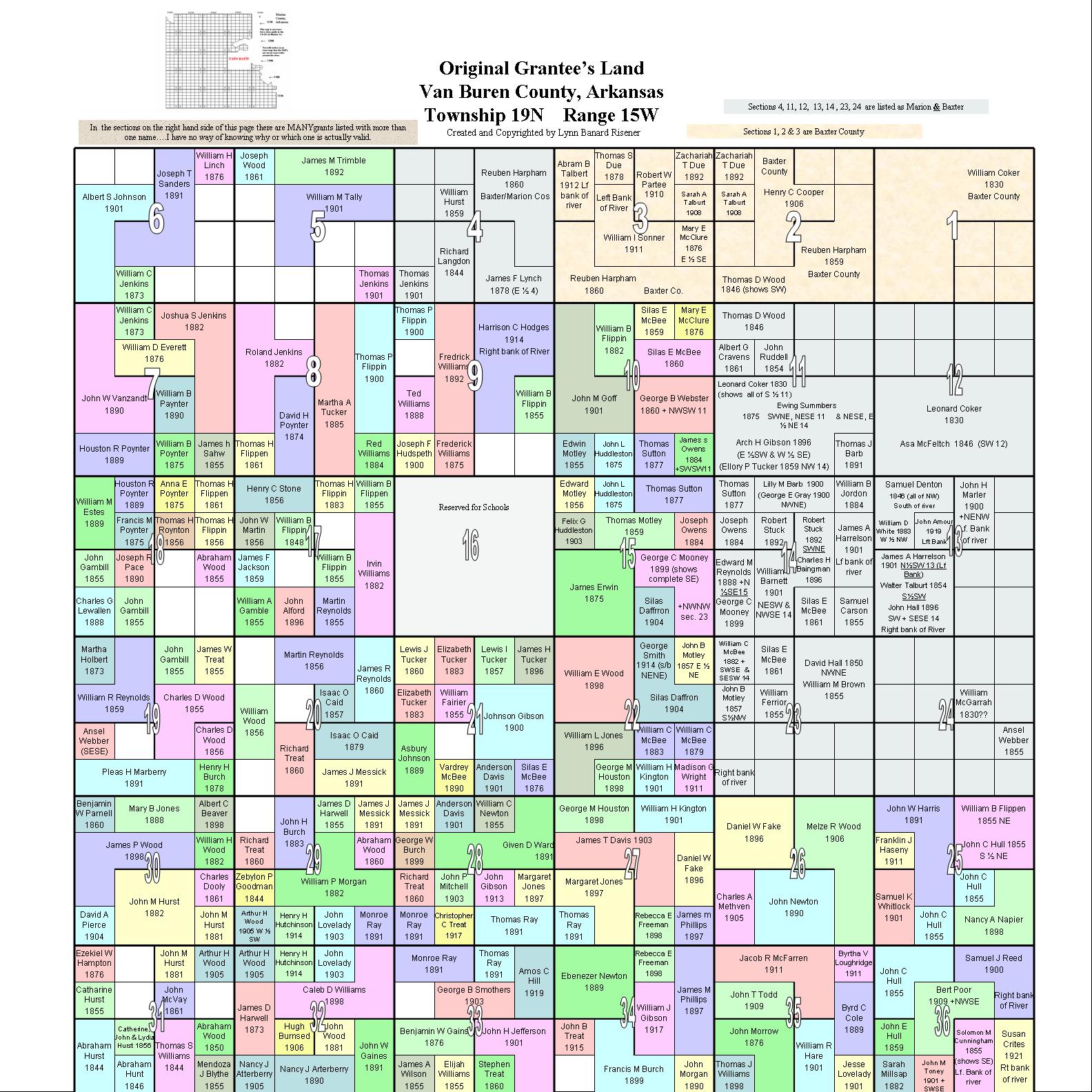
Marion Co, AR
Landowner Maps
Including Original Landowner's
Name & Date of Purchase
Maps Created and Copyrighted by Lynn Banard Risener (1996-2009)
For many years Lynn was the County Cordinator for the USGenWeb Van Buren County, AR county site. These landowner maps was a labor of love she freely shared with all the USGenWeb Arkansas County Cordinators.
PLEASE RESPECT THE COPYRIGHT
Many thanks to Lynn Risener who created these maps and granted our Marion Co AR website permission to share them with you.
To Anita, Holly & Kay a very Special Thank You for the hours they spent, compiling and verifying the 5,444 landowner names to produce the index you'll find below. It's volunteers like these that help make the Marion Co site what it is.
Arkansas is a Public Domain State meaning Marion Co has both Congressional (Federal) Townships and county townships. Not familiar with these? Spend a couple of minutes here Understanding Townships.
These maps cover only the Congressional (Federal) Townships of Marion Co AR, including the border sections of the townships shared with Boone, Baxter and Searcy counties.
Index to Original Landowner's Names Found on Landowners Maps
Indexed by first letter of landowner's surname (last name) A B C D E F G H I J K L M N O P Q R S T U V W X Y ZIf you find your ancestor's name in the index you can download his/her patent from the BLM site. With a copy of the patent in-hand you can order the Land Entry Case file. (Don't know what this means - See Linda's Land Records Tutorial)
Township Maps with Original Landowners Names
These JPG maps are very large and may take awhile to load depending on your internet speed. If I reduce the size of the maps the names can't be read. However, keeping in the mind Lynn's copyright restrictions above, these maps can be downloaded to your own computer by right clicking on the map image and selecting "Save image as".
Maps are linked to the Landowner's name in the above Indexes
Full Section/Township/Range Map of Marion County
|
Township 19N - Range 15W |
|
|||
![]()
Return to Maps Index
Return to Marion Co Home Page