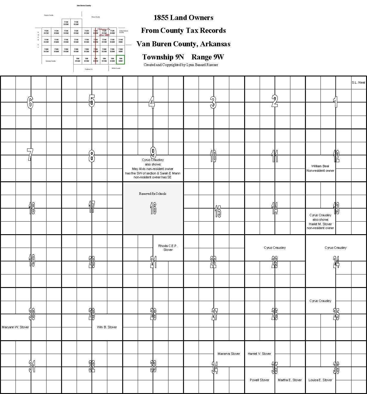
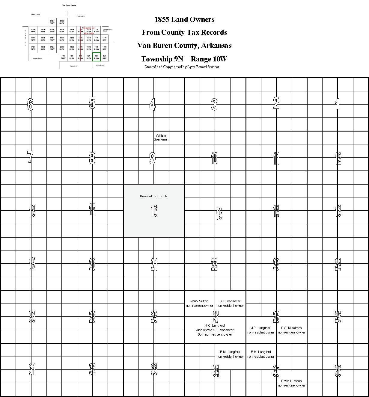
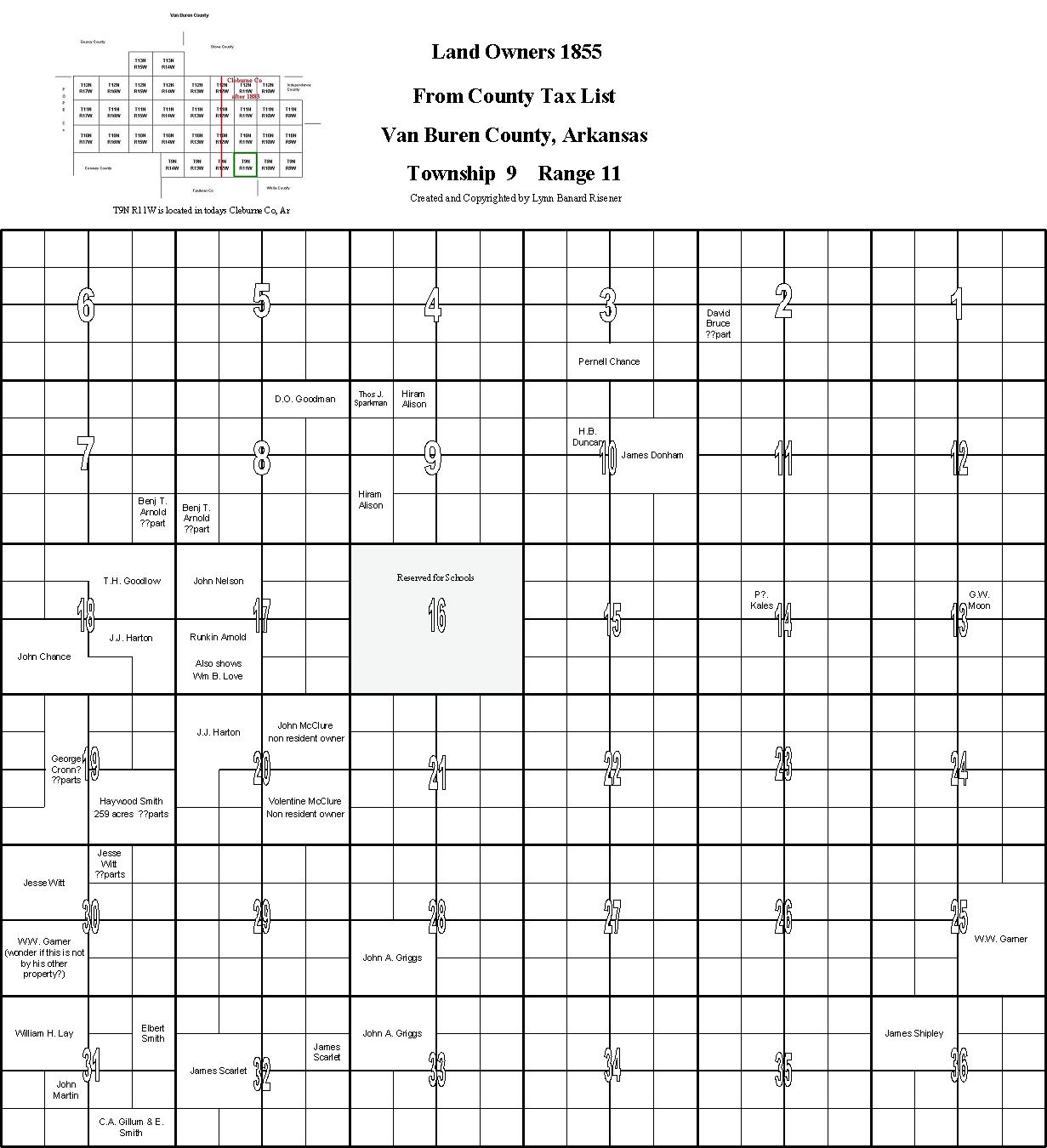
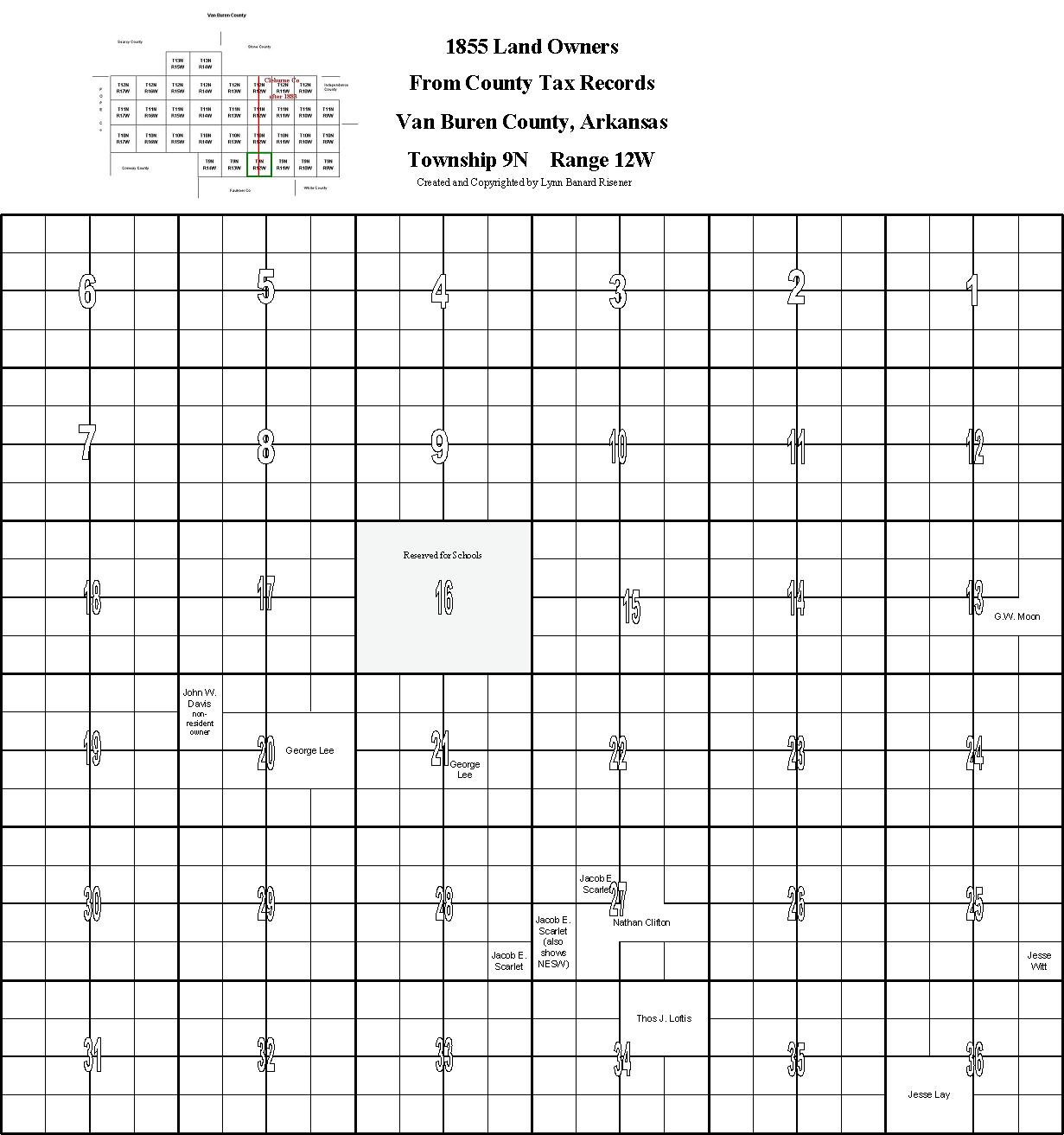
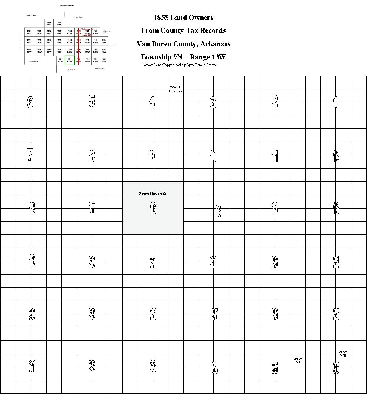
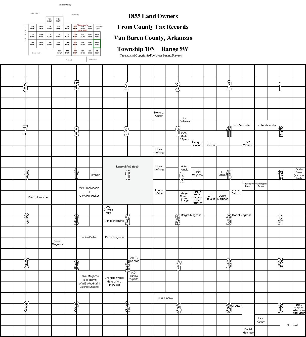
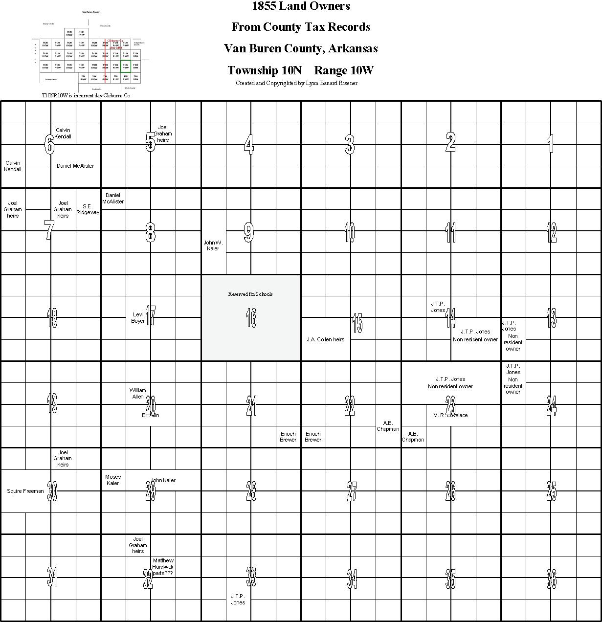
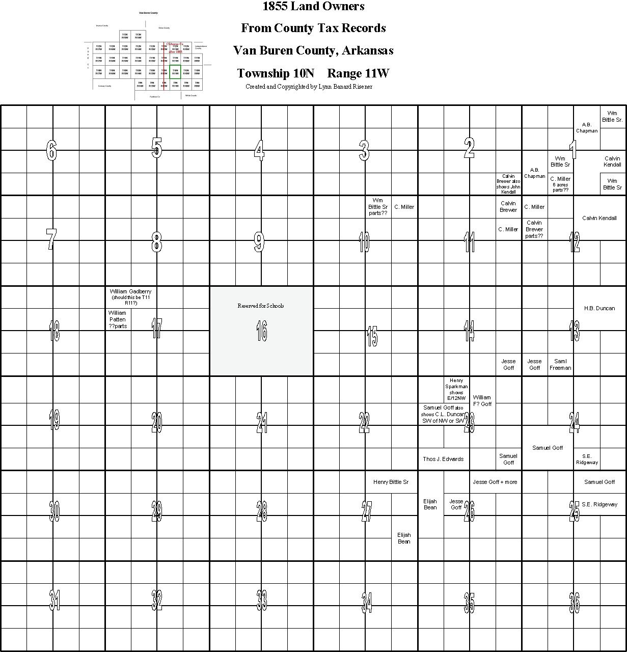
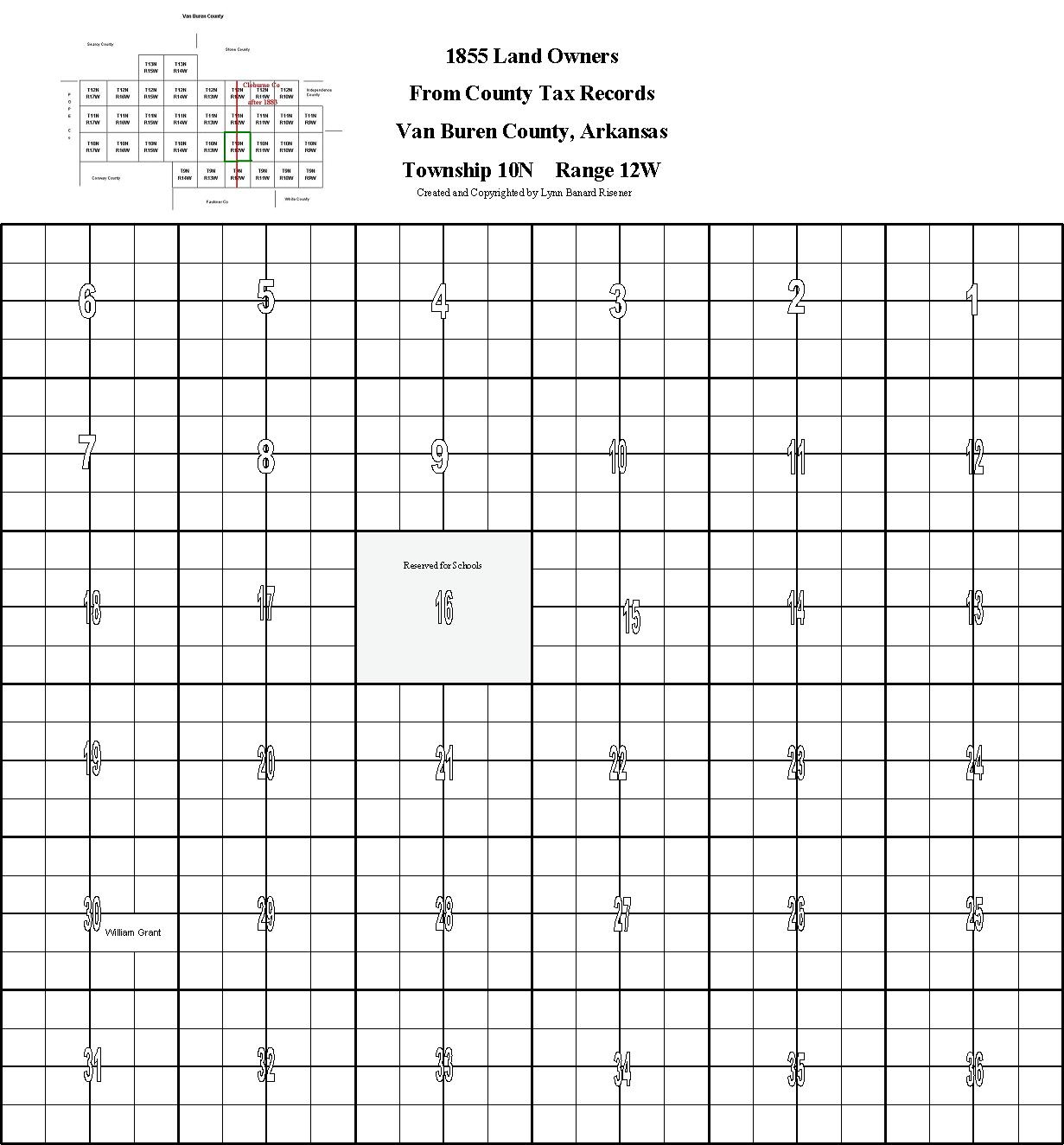
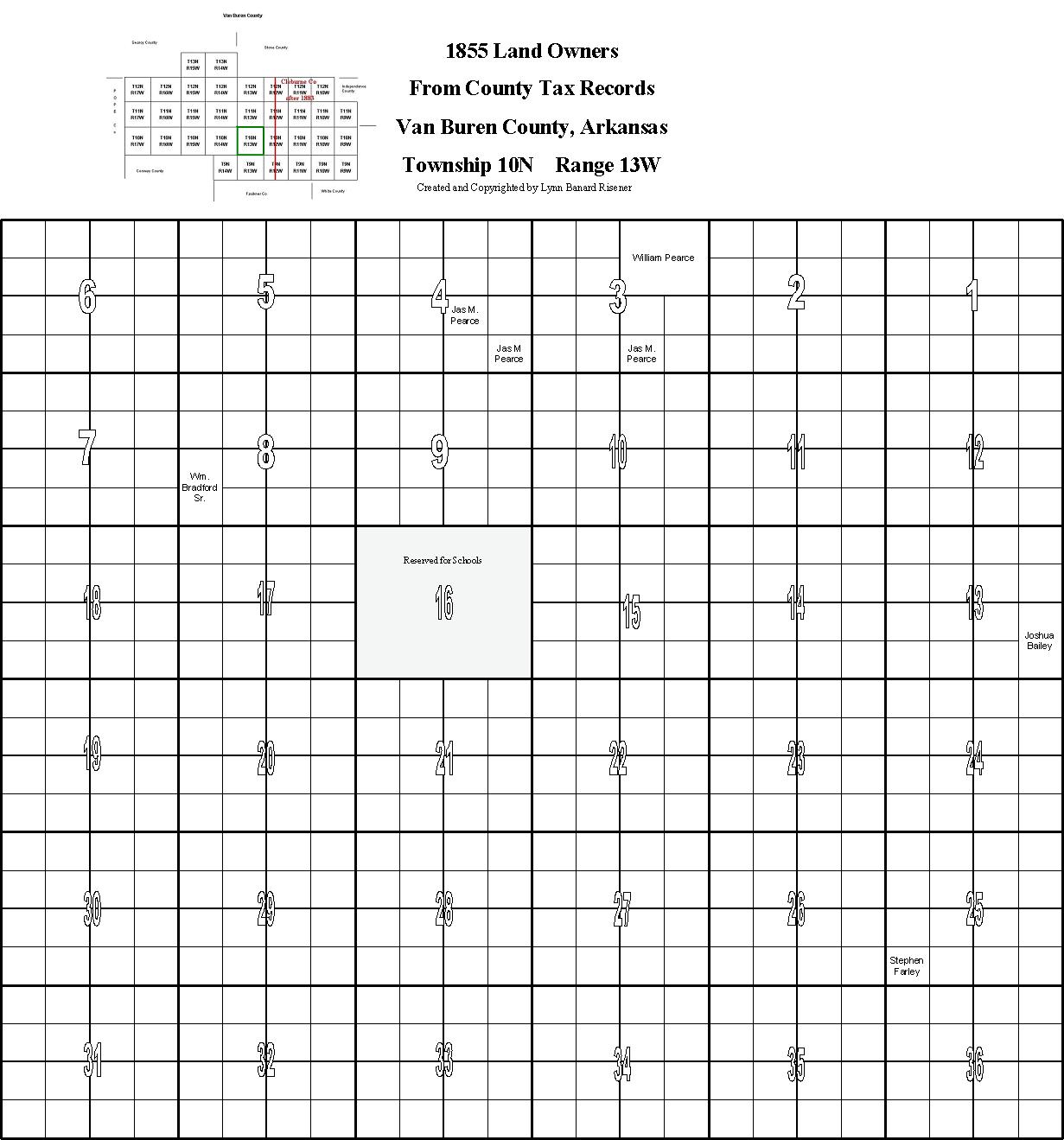
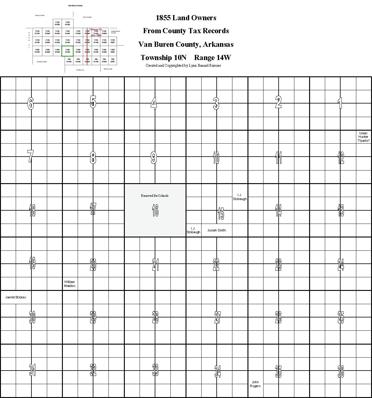
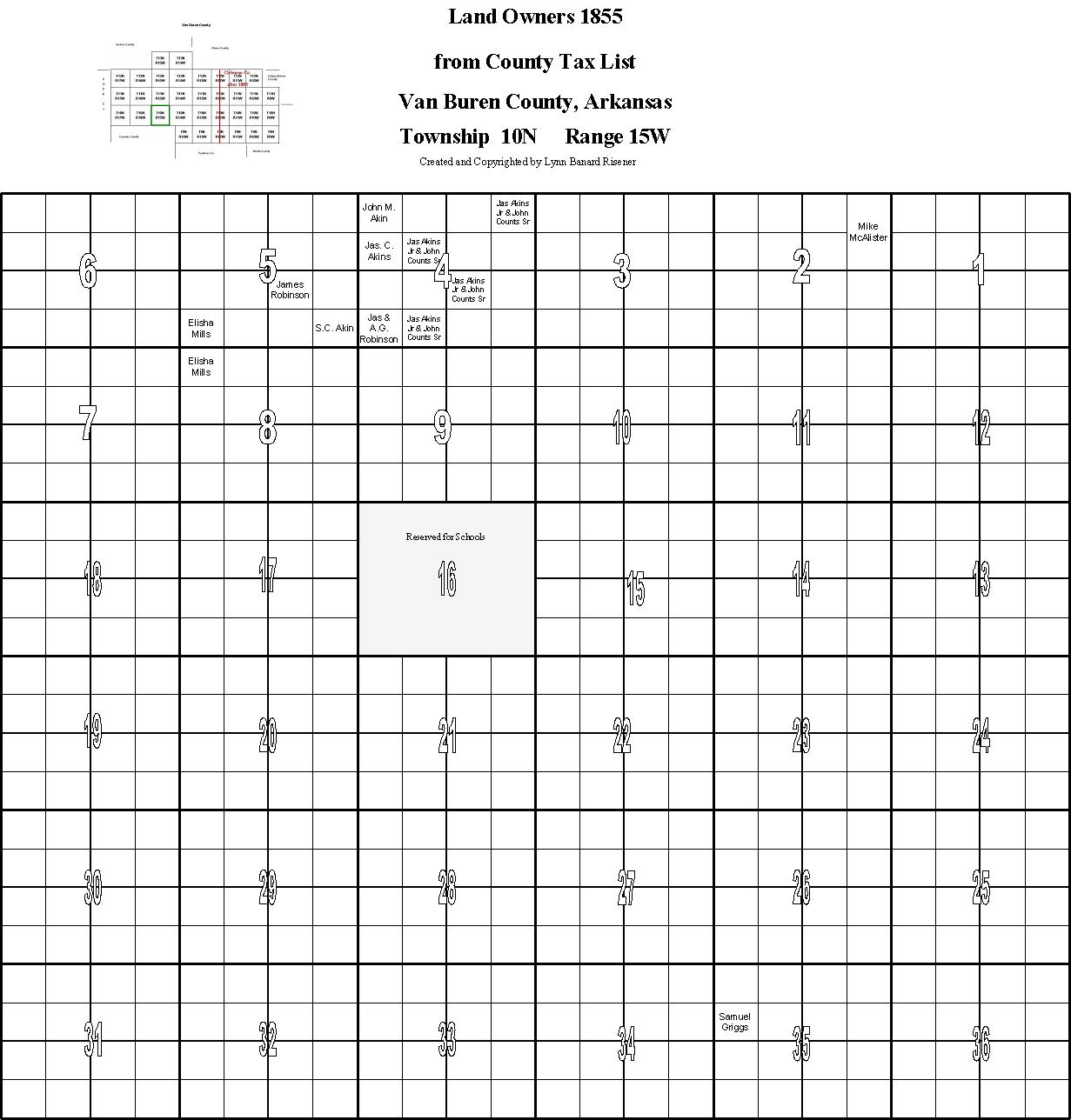
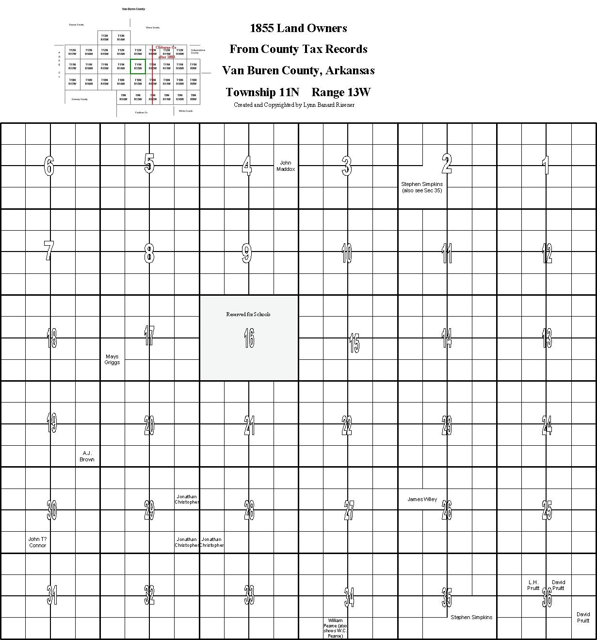
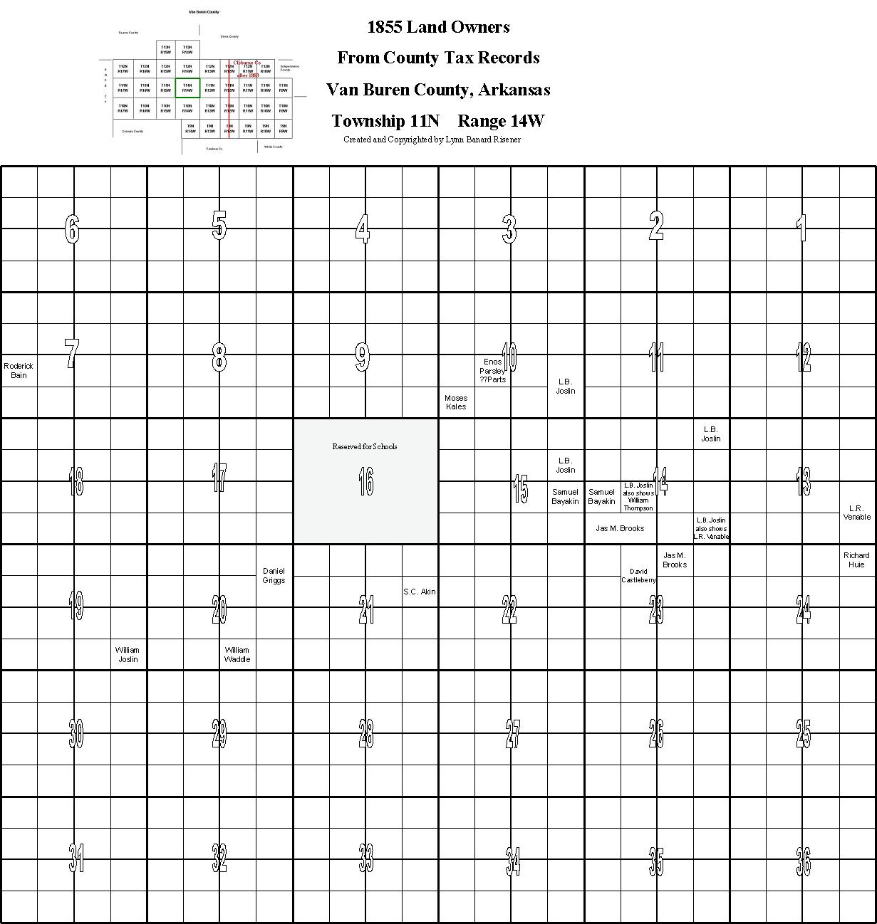
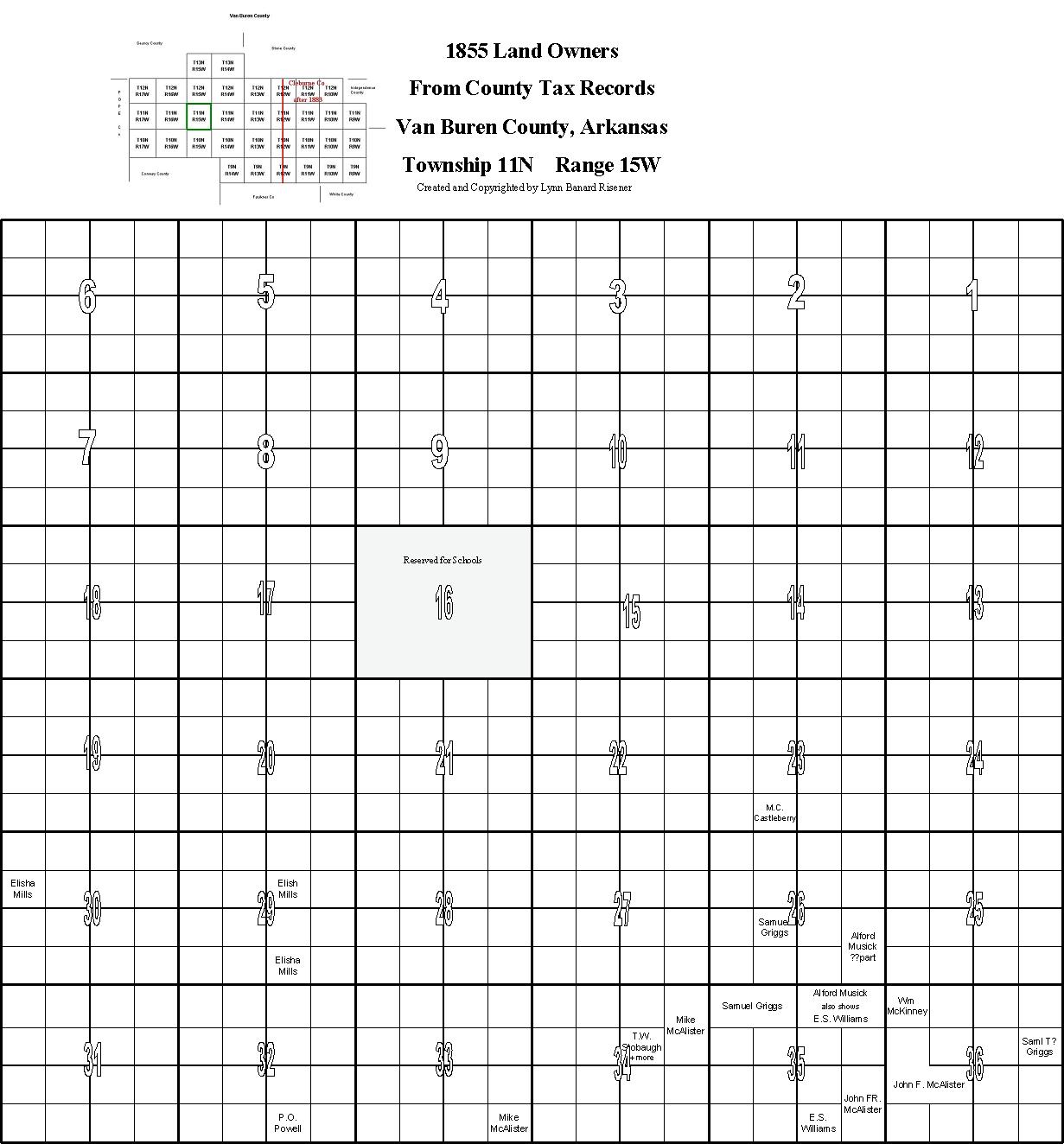
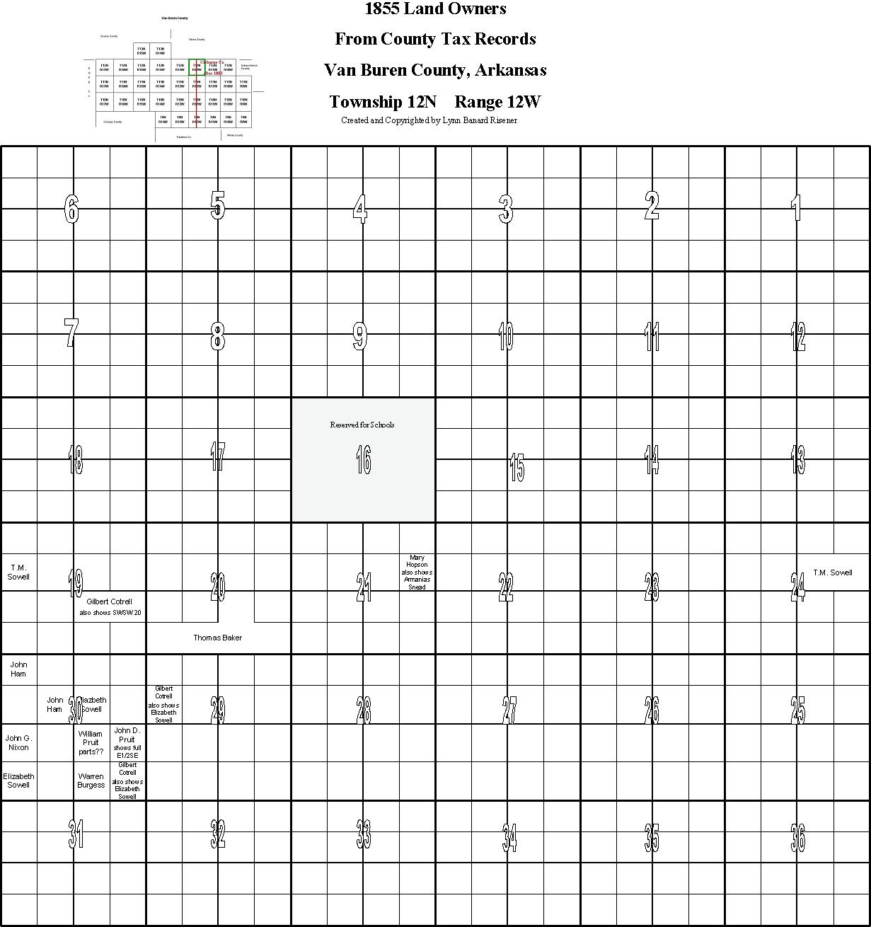
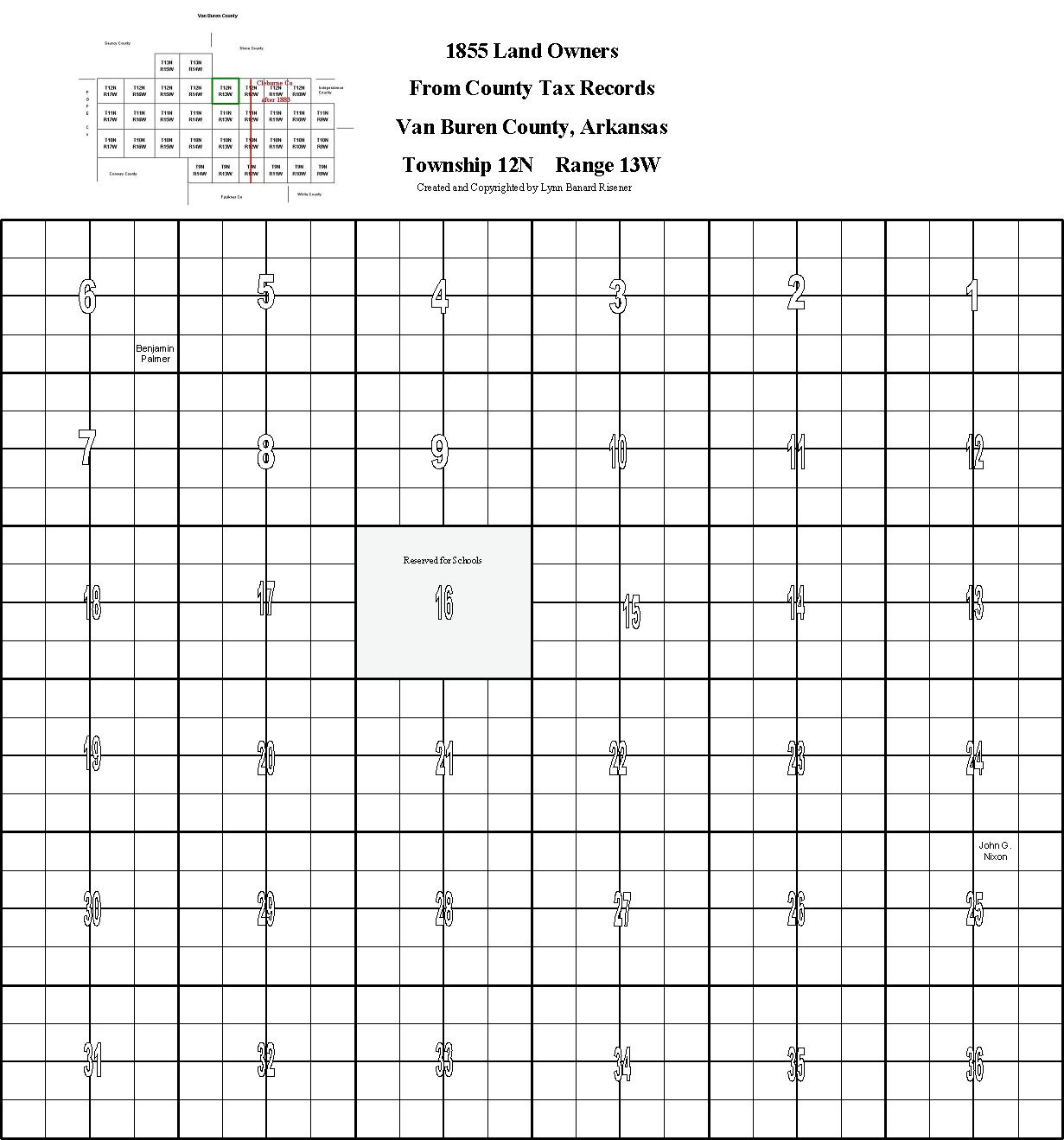
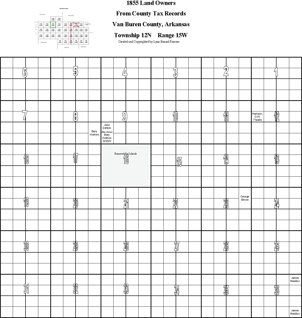
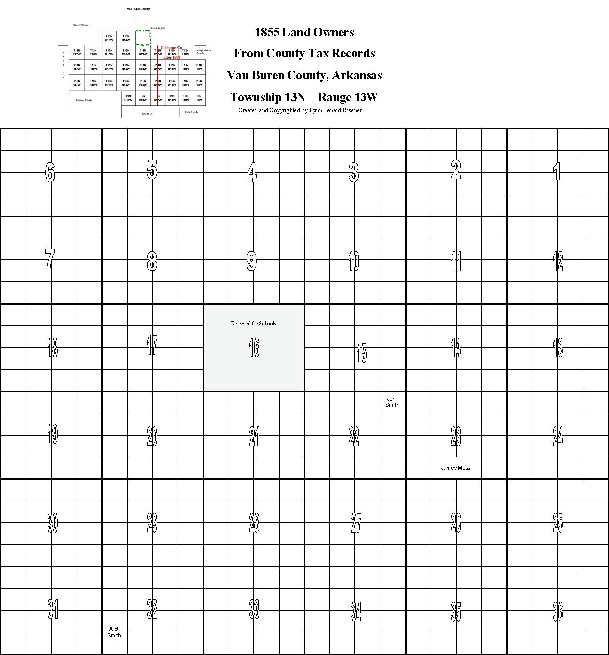
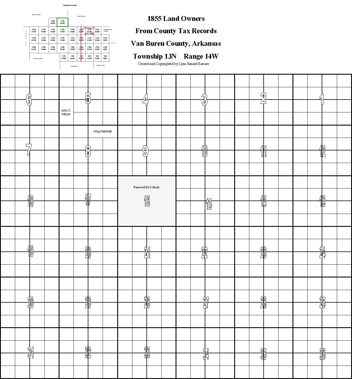
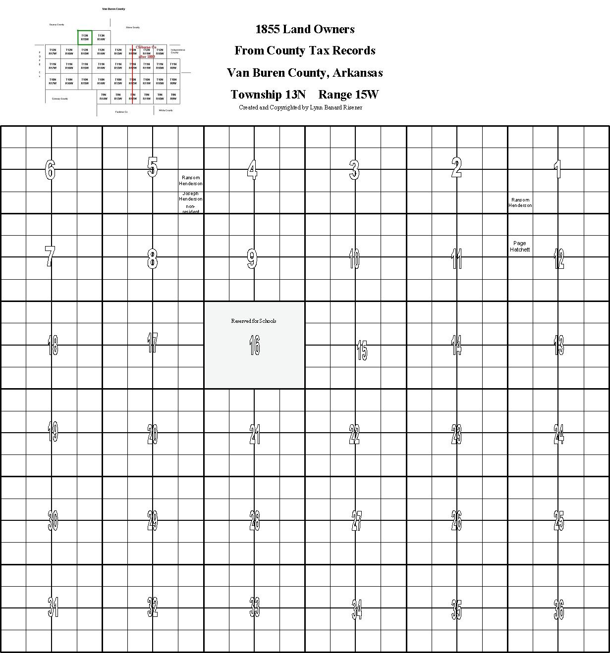
1855 Landowner Maps by Township & Range

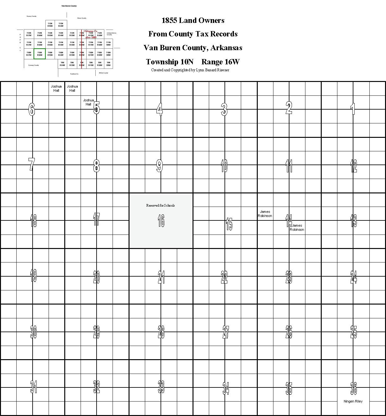
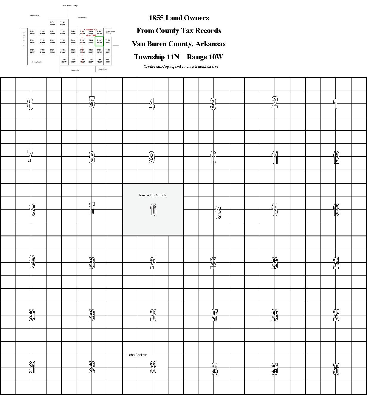
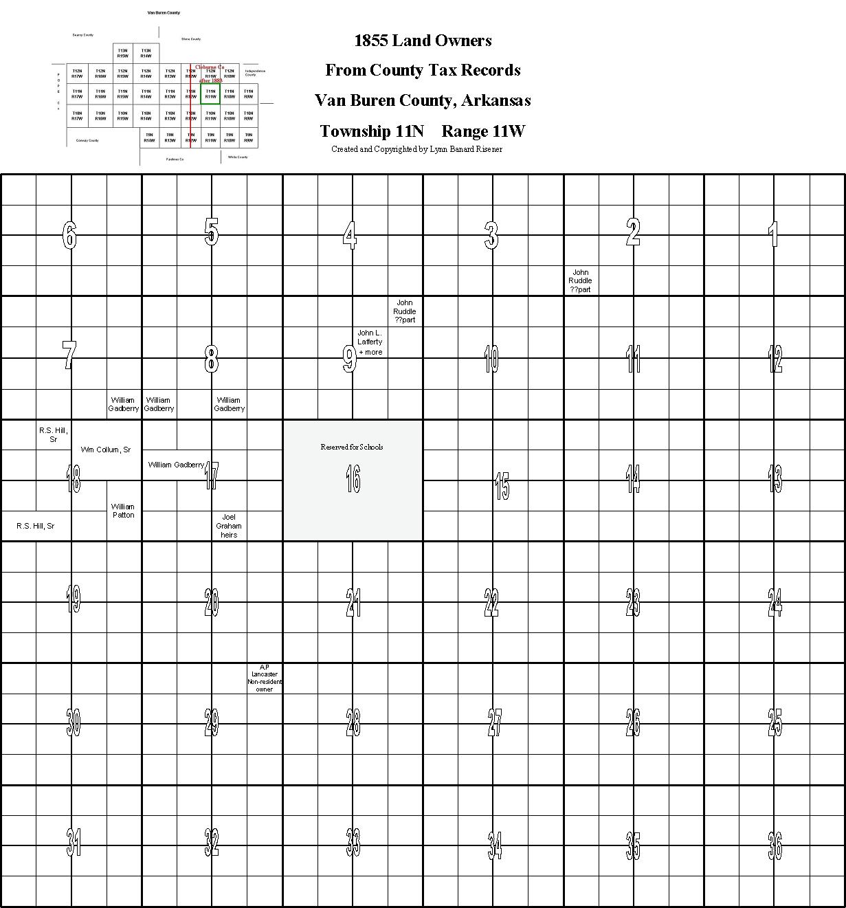
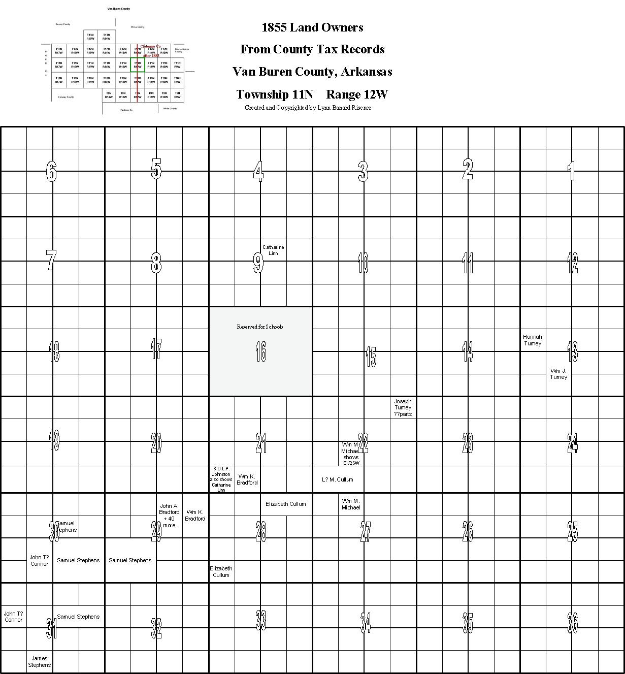
Some of the land descriptions on the tax records weren't very exact so the owners are placed "approximately" in some cases. If there is a "??parts" under that owners name I didn't know the exact location in that section but knew it WAS in that section. After doing several of these maps I feel sure that there are some mistakes on the records but have listed them just as they are recorded. Remember....land in T9-half of T12 became part of Cleburne Co. in 1883.
You might want to check the "Cemetery" page and see what cemeteries are located on or near your ancestors land from the maps there and to the "Towns" page to see what towns might be close by.

VBC landowners in 1855, T9,R9
VBC landowners in 1855, T9,R10
VBC landowners in 1855, T9,R11
VBC landowners in 1855, T9,R12
VBC landowners in 1855, T9,R13
VBC landowners in 1855, T10,R9
VBC landowners in 1855, T10,R10
VBC landowners in 1855, T10,R11
VBC landowners in 1855, T10,R12
VBC landowners in 1855, T10,R13
VBC landowners in 1855, T10,R14
VBC landowners in 1855, T10,R15
VBC landowners in 1855, T10,R16
VBC landowners in 1855, T11,R10
VBC landowners in 1855, T11,R11
VBC landowners in 1855, T11,R12
VBC landowners in 1855, T11,R13
VBC landowners in 1855, T11,R14
VBC landowners in 1855, T11,R15
VBC landowners in 1855, T12,R12
VBC landowners in 1855, T12,R13
VBC landowners in 1855, T12,R15
VBC landowners in 1855, T13,R13
VBC landowners in 1855, T13,R14
VBC landowners in 1855, T13,R15